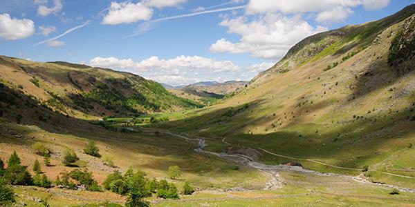
color:#333333″>Did you know that in terms of Geology, Shropshire is one of the most important counties in the UK? This is because it contains traces of 11 of the 13 recognised geological periods. You can find other treasures amongst the ancient rock, from Iron and Bronze Age remains to rolling meadows, lush woodland and babbling brooks.
color:#333333″>With so much to explore and discover within easy reach of our Upper Norton property
color:#333333″>, the best way to see everything is to get out and about on your own two feet. Grab your walking boots and set out into these iconic landscapes, drinking in the fresh air and beautiful scenery of the Shropshire Hills.
color:#333333″>To add to our collection of walks near Upper Norton
color:#333333″>, we’ve pulled together another eight of our favourite Shropshire walks for you to discover during your stay. Although these may be a little further from the property, they’re well worth the journey. From dramatic hills to stunning woodland, you’re sure to find a route which captures your imagination!
2. Linley Beeches
3. Long Mynd
4. Acton Burnell
5. Onny Meadows
6. The Wenlock Circuit
7. Rectory Wood
8. The Wrekin
Caer Caradoc
color:#333333″>Part of a range known as the Stretton Hills, Caer Caradoc is perhaps one of the most iconic of the Shropshire Hills. It’s distinctive shape and steep slopes are studded with dark volcanic rock, formed when one tectonic plate was forced beneath another in the Church Stretton Fault.
color:#333333″>The summit of Caer Caradoc is marked with a large Iron Age fort, where the British Chieftain Caradoc resisted the Romans for over a decade. Legend says that the final battle was fought on the mountain, when Caradoc was defeated by the Roman General Ostorius Scapula.

Where is Caer Caradoc?
color:#333333″>Caer Caradoc is a Shropshire hill overlooking the town of Church Stretton and the village of Cardington, around a 20-minute drive from Upper Norton.
Caer Caradoc Parking
color:#333333″>Most walkers of Caer Caradoc will choose to park at Church Stretton, which has a selection of car parks including one of Easthorpe Road and another on Lutwyche Road (both SY6 7ES). There is also a Shuttle Bus service, which starts at the temporary car park and does a circuit of the town.
Caer Caradoc Walking Route
color:#333333″>Length:color:#333333″> 3.5 miles
Approx time: 2 hours 40 minutes
Difficulty: Medium
color:#333333″>Caer Caradoc is best climbed along with the Lawley or the Hope Bowdler Hills, with the recommended starting place being the town of Church Stretton. The route will take you through the forest and up to the summit, where you can enjoy fantastic views of The Wrekin and Wenlock Edge. The walk then takes you back down to the charming village of Cardington, before returning to Church Stretton via Willstone Hill.
Find the route here
color:#333333″>
Linley Beeches
color:#333333″>Decorated with aged beech trees, this genteel walk takes you through a quiet corner of the Welsh Borders. The Linley Beeches is a row of trees that stretches for a whole mile, and was planned by Robert More, MP for Bishop’s Castle in the 18th Century. It’s a dramatic sight, stretching out and leading towards his family home at Linley Hall. Unfortunately, the current trees are not the originals, which were felled for the war effort in 1916, but were planted in 1937 and have since matured.
Where is Linley Beeches?
color:#333333″>Linley Hall, and the Beeches that lead up to it, are part of the hamlet of Linley (SY9 5HL). Linley is around a 25-minute drive from Upper Norton, located approximately 3 miles north of Lydham and 3.5 miles north of Bishop’s Castle.
Linley Beeches Walking Route
color:#333333″>Length: 6 miles
Approx time: 2 hours 40 minutes
Difficulty: Easy
color:#333333″>Starting at Lydham Village Hall, just 20 minutes from our property, you can follow the stream across the fields and towards Norbody. The mile-long drive starts at Avenue Lodge and stretches towards Linley Hall. From here, continue to Norbury where you’ll find the All Saints Church – the enormous tree in this churchyard is thought to be over 2,700 years old! From here, you can join the famous Shropshire way.
Find the route here
color:#333333″>
Long Mynd walk
color:#333333″>This famous ridge is the most popular of the Shropshire Hills walks. It’s often referred to as ‘Little Switzerland”! There are several small, steep-sided valleys (batches) which cut into the ridge and create some excellent walks to the top, the most popular of which is the Carding Mill Valley (managed by National Trust). Another gem is Ashes Hollow, which is a long and twisting valley through the wildlife-rich heathland above Little Stretton.
Where is Long Mynd?
Long Mynd can be found to the west of the Church Stretton fault, between the Stiperstones range to the west and the Stretton Hills and Wenlock Edge to the east. The ridge forms a major part of the Shropshire Hills, and the majority is owned by the National Trust. This includes the Carding Mill Valley, which is the main route by which people access the Long Mynd and the starting point to a selection of long and short walking routes.
color:#333333″>The closest towns and village are Church Stretton and Little Stretton.
Where do you park to walk Long Mynd?
There are two options for Long Mynd car parking. The first is the National Trust Carding Mill Valley (SY6 6JG) car park, which is free for NT members and costs £5 for non-members. Alternatively, Easthorpe Car Park (SY6 6BQ) is a smaller car park in Church Stretton town centre. It’s a 10-minute walk from Carding Mill Valley and costs £4 for the day.
How long does it take to climb Long Mynd?
It takes, on average, 2 hours 30 minutes to climb Long Mynd.
How long is the Long Mynd?
Long Mynd is a 7-mile long ridge, with several valleys providing lovely walking routes.
Long Mynd Walking Route
color:#333333″>Length: 5 miles
Approx time: 2 hours 30 minutes
Difficulty: Difficult
color:#333333″>The Carding Mill Valley walk to the top of Long Mynd is a challenging route, but all the effort is worth it for the spectacular views right across Shropshire. From the Chalet Pavilion (22 minutes from Upper Norton), follow the stony path running alongside the stream to the head of Carding Mill Valley, then up to the top of the hill. To return, follow the route across the moor, through the rolling heather and past the dramatic Townbrook Hollow.
Find the route here
color:#333333″>

Acton Burnell
color:#333333″>Take a wander through this dark, lush woodland and you’ll be surprised by what you find, from historic buildings to a long-abandoned church. This beautiful, circular walk in Shropshire is perfect for discovering unspoilt countryside and rich historical sites.
color:#333333″>Where is Acton Burnell?
color:#333333″>Acton Burnell is a village and parish in Shropshire, around 8 miles south of Shrewsbury with its collection of shops, restaurants and cafes. It’s easily accessible by car via both the A458 and the A49.
color:#333333″>Acton Burnell Parking
color:#333333″>While there is a small amount of free parking available outside Acton Burnell Castle, the village itself does not have a designated parking area. Therefore, if you choose to park on the roadside please be mindful of the residents and any parking signs or markings.
color:#333333″>Acton Burnell Walking Route
color:#333333″>Length: 6 miles
Approx time: 2 hours 30 minutes
Difficulty: Medium
color:#333333″>Starting in the hamlet of Acton Burnell, just over half an hour’s drive from the property, take the path opposite St Mary’s Church, through the trees and onto a quiet road to Ruckly. Here you’ll find the lane to Langley Chapel. Once a busy church and community, this idyllic, serene gem was abandoned in 1871 and now sits unhabituated in the middle of a field. Moving on, you’ll find about six miles of quiet lanes around Park Wood, a beautiful English forest teaming with wildlife.
Find the route here
color:#333333″>
Onny Meadows Trail
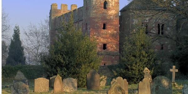
color:#333333″>Onny Meadows is made up of 30 acres of water meadows, set on the flood plain of the River Onny. Once a wonderful place to graze cattle, today it’s a favourite of walkers and families coming to learn about the nature and heritage of the Hills, with great facilities as well as beautiful surroundings bursting with riverside paths, wild flowers and woodland. The meadows are part of the Shropshire Hills Discovery Centre, which hosts exhibitions about the local area and runs a busy calendar of events and activities.
color:#333333″>Where is Onny Meadows?
color:#333333″>The Shropshire Hills Discovery Centre and Onny Meadows are located in the village of Craven Arms, reachable by the A49. It’s only a couple of miles from Upper Norton, in the next village along, and right on the southern edge of the Shropshire Hills Area of Natural Beauty.
color:#333333″>Onny Meadows Parking
color:#333333″>The Shropshire Discovery Centre has a large car park with free parking for visitors, although a £1 donation is recommended. The car park is all on one level, with designated disabled bays, making this a wonderful choice for anyone with accessibility requirements.
color:#333333″>Onny Meadows Walking Routes
color:#333333″>Length: 1.5 miles
Approx time: 2 hours 30 minutes
Difficulty: Easy
color:#333333″>If you’re after a relaxing stroll through beautifully wild meadows and along the banks of the river, the Onny Meadows Trail is a great choice. It’s a flat mile walk which starts only a 5-minute drive from Upper Norton at the Shropshire Hills Discovery Centre.
color:#333333″>The main 1.5 mile walk around the meadows is well-signposted, and there are five other trails which you can also follow. You can purchase a guide for the walks at the Discovery Centre for £1 each or £5 for all six. Find more information herecolor:#333333″>
The Wenlock Circuit
color:#333333″>The Wenlock Circuit is another route within easy reach of Upper Norton, with good views of the Wrekin and Brown Clee, dynamic countryside and the chance to visit various places of interest. There are some steep uphill sections, but the beauty of this walk is the huge range of landscapes and terrains that you will experience! Take a picnic to enjoy on the route, and this makes for a fantastic day out.
color:#333333″>Where is the Wenlock Circuit?
color:#333333″>The route starts just 25 minutes from our Upper Norton property, in the town of Much Wenlock. It’s reachable by car via the B4368 and B4378, and the nearest train stations are at Telford and Shrewsbury.
color:#333333″>Wenlock Circuit Parking
color:#333333″>Much Wenlock has several car parks to choose from, including two in the middle of the town– Falcon’s Court and St Mary’s Lane (TF13 6AE). There is also a smaller car park on New Road (TF13 6BQ), which is a short walk from the centre.
color:#333333″>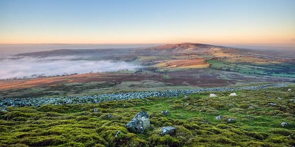
color:#333333″>Wenlock Circuit Walking Route
color:#333333″>Length: 10 miles
Approx time: 4 hours 30 minutes
Difficulty: Difficult
color:#333333″>This long, circular walk is a wonderful way to explore the local area, including the quaint town and the stunning surrounding countryside. It starts and finishes in Much Wenlock’s town centre, but quickly leads walkers out of town to explore the various pathways and walking routes surrounding it. The route travels in a clockwise direction, leading you a complete circuit around Much Wenlock and passing woodland, rivers and more on the way. You’ll visit the tranquil Anglo-Saxon ruins of Wenlock Priory, as well as beloved Much Wenlock Windmill and historic limestone quarries.
Find the route here
color:#333333″>
Rectory Wood
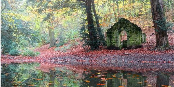
color:#333333″>20 minute from the Upper Norton property, Rectory Wood and Field is a 10-hectare site which joins the town of Church Stretton with the Long Mynd. The woodlands are beautiful throughout the year, from the first bursts of snowdrops in late winter to the reds and golds of the autumn foliage. It’s no wonder that this site was once voted the ‘least stressful spot in England’!
color:#333333″>Where is Rectory Wood?
color:#333333″>Rectory Wood is located just minutes from the town of Church Stretton, nestled in the south Shropshire hills on the English/Welsh border. The town has fantastic travel links, both by rail and by road – you’ll find it around 13 miles south of Shrewsbury and 15 miles north of Ludlow, just off the A49 trunk road.
color:#333333″>Rectory Wood Parking
color:#333333″>There are several car parks within walking distance of Rectory Wood, the most convenient of which is the one on Cunnery Road (SY6 6AF), located right beside the site. You can find a list of available car parks in Church Stretton here.
color:#333333″>Rectory Wood Walking Route
color:#333333″>Length: 1 mile
Approx time: 45 minutes
Difficulty: Easy
color:#333333″>There is a good path network through the site, with bridges across the brooks and steps up the steeper slopes. There is a family-friendly walking route which can be accessed at the link below, and provides some stunning views, ancient trees and even the chance of spotting the plethora of local wildlife! If you’re feeling adventurous, the wood has many other well-maintained footpaths and routes to explore… it’s easy to while away several hours here and not see everything on offer!
Find the route here
color:#333333″>
The Wrekin
color:#333333″>The hogs-back shape of the Wrekin can be seen from most of Shropshire, surrounded by flat land on all sides. It was formed by volcanic activity, triggered by the nearby Church Stretton fault, and today you can still find various volcanic rocks and formations on its slopes. The sides of the Wrekin are covered in woodland, but the summit remains mostly open, providing excellent views. These were taken advantage of by the Celtic Cornovii tribe, who built a 20-hectare Iron Age fort here.
color:#333333″>Where is the Wrekin?
color:#333333″>The Wrekin is found 5 miles west of Telford, and can be seen and accessed from the final junction of the M54 motorway. It’s around a 40 minute drive from our Upper Norton property.
color:#333333″>The Wrekin Parking
color:#333333″>There is a small car park at the end of the road off the M54, where you'll also find a small amount of on-road parking. There is a second popular car park between the Wrekin and the Ercall, at Forest Glen (TF6 5AL).
color:#333333″>The Wrekin Walking Route
color:#333333″>Length: 2 miles
Approx time: 1 hour 30 minutes
Difficulty: Medium
color:#333333″>For the main path up the hill, start at the car park at the Forest Glen, 45 minutes from Upper Norton. The path is well-surfaced and easy to follow, turning sharply right, then left again at the Halfway house, before rising to the open ground at the top. It’s just over a mile each way, although there are quieter, less-maintained public pathways for those who wish to escape the beaten track.
More information here

For keen walkers and lovers of the great outdoors, the idyllic Shropshire Hills are something of a hidden gem. As well as these great walks, and dozens more, the hills play host to the annual Wistanstow Challenge Walk – a must-do to any long-distance hikers. Visitors to our Upper Norton property fall in love with the rolling green hills and stunning views. And after they’ve had their fill, they can return back to this beautiful traditional farmhouse and settle into some comfortable luxury cottages and apartments. Surrounded by the beautiful scenery of the Shropshire Hills, it’s the perfect place to rest those tired feet.
Find out how you can enjoy a relaxing stay at Upper Norton, as well as the rest of our properties, here.
